 It’s hard to spot, but there’s a path into the bush in the far corner of the Quaama Cemetery. As you pass the main cluster of graves – the smart new granite of the Colemans, the Conways with their river rocks and shells, the green trellis over Pato Taylor – you may see it. Enter the scrubby remnant forest here and continue down along the path, deeper under the trees. It’s cooler in here. The light is dappled, filtering through the canopy. You can hear bellbirds’ chimes, the occasional whipbird, the zim-zippery wagtails’ calls.
Watch out for exposed roots and rocks and the occasional vine across the narrow path. After a few twists and turns you’ll reach a dip. There’s another path, really just a flattening of the grass, off to the left. Tread carefully; it’s slippery down here, the ground is damp. But soon you’ll see the creek.
For a while, during the drought, it stopped flowing and formed a series of shallow, dank pools, thick with weed and oily on top. Tiny insects would dart from puddle to puddle. You could tread through large expanses of river sand and even the deepest footfalls would draw no water.
Then the drought broke, and you’d squelch down to the creek in gumboots to gaze across an expanse of rushing brown water, roiling with leaves and sticks.
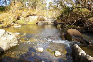
Now, behind Quaama, it’s flowing around and over large granite boulders, just slowly at the moment; we’ve had rain, but little.
Step over the rivulets at the edge and sit on a rock in the winter sun. Listen to the water trickle around you.
Dry River emerges from steep headwaters in the escarpment at Murrabrine Mountain, six kilometres north-east of Quaama. On some maps it resembles a dashed tear-along-the-dotted-line from mountains to coast as it ducks beneath the sandy bed and reappears. At Quaama it’s joined by Cadgengarry Creek (Catch-and-carry Creek, they say). And five kilometres downstream it merges with Pipeclay Creek, which drains from the gentle foothills north of the village. The river meanders through Biamanga National Park and Mumbulla State Forest, then flows into the lowland plains and fills Murrah Lagoon, about ten kilometres south of Bermagui. At that end they call it Murrah River.
But here, today, you can cross the water with a few hops across well-placed rocks. Be nimble and you won’t even get your feet wet. Or just sit on a warm smooth rock and listen to the river.